Thursday, June 28, 2012

2012, 20th - 25th June: San Agustín & Tierradentro, Colombia

The south west of Colombia is rich in archaeological burial sites, which give an insight into the philosophies of the peoples that lived in Colombia long before the arrival of the Spanish with their very different (European Christian) take on spirituality and life after death.

For the full complement of photos that accompany this blog entry, use the following link to the corresponding set in my Flickr account:


The Countryside

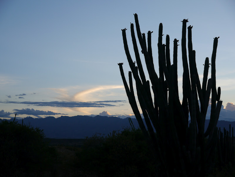
The area of the Colombian state of Cauca I explored lies within the Central cordillera (mountain range). With the elevation keeping things at a pleasant temperature and stunning countryside, it is a very pleasant place to be. The sheer length and breadth of the mountain range provides a seemingly never ending succession of ridges and valleys, all green and lush with vegetation. Most of the mountain sides are dotted with small farms / homesteads growing sugar cane, coffee and bananas.


Lush Vegetation in the Valley of Rio Magdalena near to San Agustín


Rio Magdalena near to San Agustín


San Agustín

Around the town of San Agustín are many archaeological burial sites with many statues. Much of the statuary is in the region of one thousand years old. The statues ´stand guard´ over tombs which were covered with slabs and buried.

Generally, the figures depicted by the statues wear masks and other adornments indicative of a Shamanistic type culture. The zoomorphic figures show the reverence attributed to the power of animals in Shamanistic beliefs, with the spiritual power of animals aiding the Shaman´s journeying to other planes.  Human forms are adorned with jewellery worn to symbolize animals and some figures show combined human-animal (zoomorphic) forms.  Jaguars feature regularly, as do eagles and snakes. Other symbolisms included in the statues are, childbirth, fertility and virility.

On a jeep tour I saw the sites at Alto de los Idoles and Alto de las Piedras as well as some wonderful views of the beautiful valleys in the area north of San Agustín, with rivers and waterfalls adding to the natural spectacle.


Statue at Alto de los Idolos near to San Agustín


Statue at Parque Arqueológico San Agustín


I saw many statues walking around Parque Arqueológico San Agustín. After this I walked on tracks through valleys to the north west of San Agustín past many small homesteads and plantations of coffee and various fruits. This allowed me to see the more remote archaeological sites at El Prutal, La Chaquira and El Tablon. The two tombs and statues at El Prutal were particularly striking as they still have the original paint and the symbolic adornments to the forms were clear. One statue was a male Shaman figure with a weapon in one hand and an infant in the other – it is not known whether the injured infant was being healed (by a medicinal Shaman) or whether a sacrifice was being represented. The other statue of a female represented childbirth, with the nine months of pregnancy being represented by nine eagles claws across the brow of the woman.


Statue of Shaman at El Prutal near to San Agustín


Statue of Woman Giving Birth at El Prutal near to San Agustín


Tierradento & San Andrés de Pisimbalá

 The journey from San Agustín to San Andrés de Pisimbalá was challenging as I had to take four separate collectivos. The last leg of the journey (from La Plata to San Andrés de Pisimbalá) was two hours along an unpaved mountain road (which was unsurprisingly being repaired in many sections where rivers were doing their best to erode the ground beneath the route). Fortunately I was early enough for the collectivo to get a seat inside, others rode on the roof while two guys had to stand on the rear footplate holding on for two hours along winding and bumpy dirt roads.

Around small pueblos of Tierradentro and San Andrés de Pisimbalá are a number of ancient burial tombs. The peoples of the area (like those near to San Agustín) also believed in the spiritual power of animals and their decoration of some tombs as well as the burial urns included jaguars (strength and life-giving power of the sun), snakes (the cycle of life, the process (progression) of life and death, a sexual symbol and transformation of the universe), salamander (male sexual symbol, fertilization, transformation and new life), centipedes (female sexual symbol and procreation). All animal symbols represent new life, resurrection (as opposed to other religion´s concept of death).

The ancient peoples buried their dead in a primary burial site. After fifteen to twenty years, the bones of the dead were removed and placed inside burial urns. These urns were placed inside underground tombs where the urns of many generations of the same family were kept.


Collapsed Burial Tombs at Alto del Aguacate near to Tierradentro


Burial Urns in a Tomb at Alto de Segovia near to Tierradentro

Some of the tombs in the area were painted and regularly included a human face carved into the rock with the simple shape of an inverted triangle. The most interesting tombs were at the Alto de Segovia (painted tombs) and Alto del Aguacate sites. Reaching the latter involved a long and humid climb to its impressive position on a ridge at 2000 metres. Many of the tombs at Alto del Aguacate were collapsed, but one of the intact ones contains some original painted symbols of salamanders (male sexual symbol, fertilization, transformation and new life).


Painting of a Salamander in Tomb at Alto del Aguacate near to Tierradentro


Tomb at Alto de Segovia near to Tierradentro


Tomb at Alto de Segovia near to Tierradentro

Wednesday, June 27, 2012

2012, 16th - 19th June: Neiva & Desierto de la Tatacoa, Colombia

Getting There

The majority of my time in Colombia has been spent at a degree of altitude – either mountain walking, in coffee growing districts or in cities which are situated in mountain valleys (such as Bogotá and Medellín). As a result, is has been easy to forget at times that I am not that far from the equator. Well that all changed with a visit to Desierto de la Tatocoa which is approximately 40 km north of the city of Neiva (desierto means desert and Tatocoa is a type of snake). While I was there, in the early afternoons the temperatures reached more than 40 Celsius.

For the full complement of photos that accompany this blog entry, use the following link to the corresponding set in my Flickr account:


I did hope to complete the journey in one day from Salento (via the cities of Armenia and Neiva) to the pueblo (small town) of Villa Vieja which is on the edge of the desert. Alas, as some of my other blog entries have already evidenced, South American bus journeys do not always go to plan. The delay in this one though was not due to landslides but a cycle race, which was apparently important enough to close the only route across the mountains from Armenia to Neiva for four hours. These days when travelling I keep Spanish language notes in my day bag to allow me to do something useful during the inevitable delays. Being stuck for four hours at some random road junction (fortunately near some shops and cafes) was another of those South American WTF (What The ****) moments, but I soon shrugged it off and passed some moments being amused by the fact that if it happened in Western Europe it would kick-off for sure, but here no one seems too bothered. All that malarkey meant that I arrived in Neiva an hour after the last collectivo to Villa Vieja had left (collectivos are jeeps or cars that run along a designated route, waiting until they are full before heading off). As a result, I was forced to find a hotel in Neiva.

During the last few weeks of June there are a series of festivities in Neiva, with some sort of street procession every day. I thought, hey I can stay an extra night and soak up the fun. Alas, the procession on my extra day in town was limited to some women in regular clothes riding some horses down the street – rather unexciting (though I´m sure that the processions on other days were more colourful).

The next day, upon arriving at Villa Vieja I found a guide with a moto-taxi (realistically the desert is too large and too hot to be seen in its entirety by foot). This meant that during my tour I could call by some of the posadas and select one I liked – allowing me to spend my nights in the middle of the desert which was a great way to soak up the beautiful environment.

The Desert

The desert is not a classic sand dune affair, rather more like a miniature version of the hot landscapes found in some parts of the South West of the USA – with land forms carved into strange statuesque shapes by the elements with cacti scattered amongst them.


Water-Sculptured Earth in Numerous Shades


The Reds & Browns of Cuzco in Desierto de la Tatacoa


The land itself is rather fragile as it is a mix of earth and compacted sand. It is however this fragility that has resulted in the carving of the land by the rains which fall approximately every three months. Across the desert one can find a wonderful colour palette, with browns, reds, creams and greys (with the browns, reds and creams closer to the region of the desert called Cuzco and the greys in the area called Los Hoyos). In places sedimentary material from different geological times is layered in the earth, which once exposed by the effects of the rains reveals a layering of colours. The wonder of the landscape is furthered by the finger-like shapes spreading out from layered ridges in the earth, which create three-dimensional creations in all directions.


A Stunning Colour Palette in the Evening Sun


Cacti & Vast Desert Skies 


Grey Earth Forms in Los Hoyos in Desierto de la Tatacoa


Water-Sculptured Grey Earth in Los Hoyos in Desierto de la Tatacoa


Cacti Near Cuzco in Desierto de la Tatacoa


The desert views are framed by mountains to the east and west (the Orientall and Central cordilleras respectively – where cordillera means mountain range). During the day the rising air currents above these mountain ridges create vast cloud forms, creating a beautiful backdrop to the array of colours in the desert foregrounds. As the sun descends at the end of the day the clouds are lit by a soft yellow backlight set against an electric blue canvas.

I visited the observatory in the middle of the desert which gives lectures after sunset. The resident astrologer uses a powerful laser-pointer to highlight many of the constellations and also uses some telescopes for a closer look at star clusters and planets such as Saturn (its rings were visible).

My early morning departure from the desert gave me a further display of its colours in the morning light, with the cordilleras in different hues too.


Cactus Silhouetted Against an Electric Blue Sky

2012, 13th - 15th June: Salento, Colombia

For the full complement of photos that accompany this blog entry, use the following link to the corresponding set in my Flickr account:


Salento, a small town in ´Zona Cafetera´ (coffee district), is famed for its coffee plantations and nearby valleys in which grow the majestic palma de cera (wax palm) trees.

The mountains here are a soft and lush version of the Andes, without the imposing high peaks found elsewhere, but very beautiful nevertheless. The vast swathes of green are evidence that this is a great place for crops – as long as you are a farmer who can live a rugged life on the steep-sloped land. The terrain is a clear reason why horseback is the favoured mode of transport around the valleys once away from the main roads.

Coffee Plantation

Being someone who is seriously into their coffee, to see the plants, beans and processing first hand was a treat. I took a tour of a small plantation and received enough facts and interesting anecdotes to keep even the most ardent espresso enthusiast entertained. I shall try to recall some of the highlights in this blog. If my memory has faltered and some of the facts are incorrect, no doubt there will be a barrage of feedback in the comments section below.

The coffee plant grows at altitudes between 1400 and 2000 metres (4590 to 6560 feet). I suppose if us Brits were to build a greenhouse with some light boxes on the summit of Ben Nevis we might just get one bean per annum to make a tiny cup once a year on Burn´s night (the ´och-aye-espresso´).


Ripe Coffee in Red & Yellow Shells


There are two types of coffee beans – the Robusta and the Arabica, the former being higher in caffeine but a bit harsher to the palate, the latter being smoother. There are sub-varieties of these two types. In Colombia they grow Arabica beans. The traditional varieties need a lot more TLC and more specific conditions (such as shade), whereas the modern varieties guarantee a higher yield (for one thing they can be planted closer together than the traditional varieties). Hence the vast majority of beans are from the modern types of trees.

If left to it´s own devices, the coffee plant would grow to the size of an apple tree, but that would make picking the beans a pain so they are maintained at about human height. Each time they flower and produce beans, that section of the tree does not flower again. Instead the branch grows on outwards and flowers further out in the next cycle. It takes some years for the tree to establish itself and it does not start producing good yields for some years (peaks around 4 or 5 years I believe). After that yields start to drop off, and apart from minimising the decline in subsequent yields by pruning, the productive life of a tree is around 15 years. The beans are house in a shell. While growing, the shell is green and they are ripe when the shells are either red or yellow (both colours exist). They are picked by hand.


Coffee Beans (Just After Having Had the Shells Removed)


An overview of the processing is roughly as follows. The shells are removed (revealing the two beans inside each one – the colour of the beans is a greyish very pale green). They are soaked and washed in water to remove the natural sugars (if this is not done when the beans are roasted the sugar will burn the beans making the coffee much more bitter). They are then dried (in the warmth of the sun), after which the ´skin´ of the beans is removed. At this point in the cycle they are traded and (more often than not for the Colombian beans) exported. The roasting (a skilled process) is normally done in or near to the country of consumption. I believe that the Italians are regarded as the best coffee roasters.


Washed & Dried Coffee Beans (Not Yet Roasted)


What with the removal of the shell, the washing and drying and removal of the ´skin´, the beans lose a lot of weight and by the time they are sold, the weight is only 18% of that which came off the tree. When they are traded, the price offered by the merchant is updated twice a day. Interestingly, I have seen on the news on Colombian television at the point that they report the day´s fiscal data (such as exchange rates) they also quote the price per kilo for coffee – just shows how important this cash crop is to Colombia.

To any potential visitors to Colombian who think that this is the Mecca for coffee – be warned: Most of the population here, very surprisingly, do not really ´get´ coffee and the vast majority of stuff you buy in cafes etc is frankly naff. With a distinct lack of coffee connoisseurs in Colombia and with only a handful of people with expertise in roasting the beans (as mentioned earlier this is a tricky art), the country that is perhaps the most famed for coffee production is a place where a decent espresso is a rarity. If you want a coffee treat on every street, go to Italy.

Valle de Corcora

The main attraction of Valle (valley) de Cocora is the stunning sight of the palma de cera (wax palm) trees. These palms are very slender and tall (around 60 metres (200 feet)), with the leafed section solely at the top. Set against the backdrop of the lush mountain sides, frequently amidst creeping mists, they make a mesmerising sight.


Wax Palms in Valle de Corcora


My early start for my walk in Valle de Corcora afforded me views free of mists in all but the tops of the surrounding ridges, enabling me to see my first sights of the wax palms in their lush green settings. After climbing alongside Rio Quindío to the Reserva Acaime, I walked part-way down before taking an alternative route back. While climbing towards Finca la Montaña, the low clouds moved in. While this did obscure the wider vistas, it transformed the sights of the trees into something quite different. From a distance in the grey light the palms were almost black and when entirely blanketed in mists, their forms were ghost-like and the sight was akin to a dreamy subsea scene.


Beams of Sunlight Across Wax Palms in Valle de Corcora


A Misty Wood Above Valle de Corcora


Mist-Enveloped Wax Palms in Valle de Corcora


An Underwater-Like Scene in Valle de Corcora


Descending towards the valley below, I dropped below the cloud line and was presented with a new vista. With the grassland kept short by grazing cattle and the sculpture-like palms in every direction, the scene was like a vast ´palm garden´. A truly beautiful sight to marvel at as I walked back to the road to end a truly memorable day.


A Garden-Like Scene in Valle de Corcora


A Beautiful Array of Wax Palms in Valle de Corcora

2012, 18th March - 12th June: Medellín, Colombia

For the full complement of photos that accompany this blog entry, use the following link to the corresponding set in my Flickr account:


Well, my time in Medellín....there is quite a story here. The overview:

~ Arrived in Medellín expecting to stay for around three days, ended up staying for nearly three months. The reason...
~ On my first day in the city I fell ill and went to hospital to have emergency surgery to remove my infected appendix.
~ Decided not to go home and to recuperate in Medellín instead.
~ Connected with a great local family and stayed with them.
~ Took Spanish classes, practiced my Spanish.
~ Met a beautiful local woman.
~ Stayed so long I went over the duration of my tourist visa and had to go begging at the DAS (immigration service) office.


Feeling Tip-Top Here (About 5 Hours After Surgery)


Medellín & The Paisas

A note on pronunciation: Medellín is in the Colombian state of Antioquia, where they have their own way of pronouncing the ll (double l). The double l is a regular inconsistency across the Spanish speaking world, with many different countries, and even regions, having their own take on it. In Antioquia they say it like a fusion of j and ch (with the j said as it is said in English - not I hasten to add how j is said in Spanish which is very different). So with the accent on the i, Medellín is pronounced ´Medajcheen´ - the best phonetics I can come up with).

Medellín is a large city (around 2.5 million inhabitants) situated in a valley between two of the cordilleras (ridges) of the Andes. With the resulting elevation (of around 1500 metres), the climate is very manageable for a Brit like me. Indeed it is this climate that earns Medellín the name ´city of the eternal spring´.

While Medellín has all the elements one would expect from a good city (businesses, shops, good transportation, arts, nightlife, etc), for the classic tourist on the South American circuit it does not have any really big draws. However, as a place to spend some time getting to know the locals (the Paisas) it is just great. Also, it is a good place to improve your Spanish as the Paisas pronounce their words well without heavy accents (such as those reportedly found on the Caribbean coast of Colombia).

A ´Paisa´ is someone from Antioquia, and the Paisas are a thoroughly nice bunch – very friendly, warm, welcoming and happy to help. From the families I knew well to taxi drivers and shop keepers I was frequently impressed. Throw into the mix a lot of mujeres bonitas (beautiful women) and the result is a rather nice place to hang out.

Around Medellín

So, what is a chevere or bacano (both mean cool) thing to do on the weekend while you´re in Medellín? Visit one of the many pueblos (small towns) in Antioquia in the countryside around Medellín. This will likely involve taking a bus which will climb over one of the two mountain ridges which frame Medellín before dropping down into another valley. Many of the towns are at a lower altitude making them hotter than Medellín, so a town with one or more rivers where you can cool off is ideal. I spent weekends in Guatapé, San Rafael, Santa Fe de Antioquia and La Pintada.

The highlights of Guatapé are the rock and the lakes. The rock (El Peñol) is a huge geological anomaly – an acorn shaped rock around 220 metres high that rises alone out of the local landscape. It is surrounded by a large lake, which due to its numerous inlets looks like many small lakes. The lake was formed as part of a hydroelectric scheme. Climbing the 649 steps to the top of the rock affords spectacular views across the many waterways.


View From El Peñol at Guatapé


The Lake at Guatapé


San Rafael (one hour further on from Guatapé) is a great town that buzzes at night and where the most common way to get around is by moto-taxi (motorised rickshaws). San Rafael is surrounded by rivers which are crystal clear and a great relief from the heat. There are many great spots for a dip, some with waterfalls and spots to jump in from a height.

Santa Fe de Antioquia dates back to the 1500´s and is very attractive with old calles (streets) and plazas (squares). The Rio Cauca races by the town – alas too powerful for swimming.

La Pintada, also on Rio Cauca but further south, is pleasant enough but is spoilt a little by the principal route from Medellín to Manizales passing through the small town.


Calle 10 (Towards Plaza de Bolivar), Santa Fe de Antioquia


Rio Cauca, La Pintada, Antioquia


My Friends in Medellín

What with the Paisas being such a nice bunch, I grew close to many people while in Medellín (one person in particular). This made it very difficult to leave and in fact once my post-surgery abdominal muscles were (more or less) sufficiently strong to start lifting heavy backpacks onto buses etc, I regretted that I had run out of medical excuses to stay in Medellín and had to admit to my friends there that I was staying to be with them.

I felt very emotional saying goodbye to all of them. My first stop after Medellín was Salento (see next blog entry). Salento, though very nice, is a tourist town with its fair share of backpackers. It came as shock to my system because there was a noticeable contrast between the ´more genuine´ experience of really connecting well with the locals and the more ´samey´ conversations that one has with fellow travellers (no disrespect to my fellow backpackers intended at all). Add to that the fact that alas often the conversations in hostels are in English which is bad for any budding Spanish speakers like me.

Anyway, I feel sure that I will be back in Medellín sometime in the near future – after all it is super chevere!


Me With Some of My Host Family


More Great Paisa Friends


2012, 13th - 17th March: Bogotá, Colombia

For the full complement of photos that accompany this blog entry, use the following link to the corresponding set in my Flickr account:


While not a record breaker, Bogotá´s altitude at 2600 metres (8500 feet) is sufficiently high for Colombia´s capital city to be a touch on the chilly side at times, with regular rain and air thin enough to make rotund folk breathless on stairs.

The La Candelaria district where I stayed is the historic centre of the city, with sights such as Plaza de Bolivar, the Cerro de Monserrate teleférico (cable car) and numerous museums nearby. La Candelaria has a ´shabby chic´ feel, but has plenty of character and is memorably different to some barrios (districts) of other South American cities which are just too geometric (following the ubiquitous grid system for street layout) and architecturally unimaginative.


Iglesia del Carmen, La Candlaria


Atop a steep hill behind the La Candelaria district is the Cerro Monserrate teleférico (cable car) which takes you to the summit where there is a church and commanding views of the city below. Being six foot four of wind and piss, my height makes it pretty difficult to blend-in in South America. This was evident at the top of Cerro de Monserrate where some school children were fascinated by such a human anomaly and excitedly assembled for photos with the very tall guy.


Cerro de Monserrate Teleférico 


El Gringo Alto Con Colombianos


One day, Brian from Ireland (who I met in the hostel) and I hired some bicycles and completed a ´follow your nose until you find something interesting´ cycling tour of the city. This took in some of the less salubrious districts, including the La Maria and En Consuelo barrios which have great views of Bogotá from their position on the hills that flank the city. While cycling up those very steep hills, the altitude was evident with my lungs going into overdrive. In En Consuelo, eating with the locals in a café gave us a super cheap lunch.


During Cycle Tour - La Maria Barrio
 

In Museo del Oro (Museum of Gold) I was particularly interested in the artefacts which relate to the Shamanistic culture that was present in the indigenous communities (before the Spanish invaders). The artefacts frequently represented the animals and animal combinations that are used in Shamanistic journeying.


Artefact in Museo del Oro


Tim the Tool


In the hostel in Bogotá I was fortunate to meet Bo from Korea. Her kindness was apparent when after journeying to Medellín with me she visited me and generally looked out for me for my first few days in hospital there (see next blog entry).


Tim & Bo with Colombian Beers