Saturday, December 31, 2011

2011, 16th - 21st December: Ilha de Santa Catarina, Brazil

2011, 16th - 21st December: Ilha de Santa Catarina, Brazil

For a full complement of photos use the following link to the corresponding set in Flickr account:

http://www.flickr.com/photos/67212524@N04/sets/72157628654248523/

My time on Ilha de Santa Catarina was my first beach experience during my South American adventure - how different to the ice fields of southern Patagonia! While relaxing on the beaches there I felt like I had arrived in Brazil. Ilha de Santa Caterina is a large island in southern Brazil. The city of Florianópolis is located where the island almost links with the mainland. I chose to stay in the south of the island which is less developed and was happy with this choice because the area was chilled with friendly people and much quieter beaches. I stayed in a hostel right on the beach in the small town (village really) of Pântano do Sul.


The Beach at Pântano do Sul


During my time there it was great to feel so refreshed by swimming in the sea every day. Some highlights of my stay are:

A walk from Pântano do Sul across a rocky headland to the beach at Lagoinha do Leste (which can only be reached this way or by boat). On this beach I did some body surfing.

A visit to the Parque da Lagoa do Peri (a lake) for a short walk through woodland with large bamboo plants and a swim in the lake.

An afternoon near the beach at Joaquina where there are sand dunes so large people snowboard down them (a great place for photos).


The Sand Dunes Near the Beach at Joaquina


The most memorable day for me was a trip on a boat from Armaçao to Ilha do Campeche. This small island is protected (for it´s wildlife and some ancient archaeological features such as stone carvings cut into the rocks 5,000 years ago). The beach on the island is idyllic with crystal clear water, yellowy white sands, palm trees and charming rock features - possibly the most beautiful beach I have ever been on (though I´m sure South America will deliver more).


The Beach on Ilha do Campeche


One fun night, the beach bar owned by the hostel proprietors had a group of local musicians playing Brazilian folk songs. They were a very friendly bunch and made me feel welcome. One of them played an instrument called a cuíca. This is like a drum with a skin pulled taught at one end of a cylinder. Attached to the inside of the skin in it´s centre is a thin piece of straight bamboo. With one hand inside the instrument the musician slides a piece of wire wool up and down the bamboo to excite it. The resulting vibrations resonate in the cylinder. The instrument is essentially two-tone as the musician can create two pitches - one without touching the outside of the skin with a finger of his free hand and another (higher-pitched) sound by pressing down on the outside of the skin. A classic sound this makes is ´ooo-eh-ooo-ooo-eh´ and is a classic Latin-American / Brazilian sound which is present on many of the latin-influenced house records I like. It was great to actually view one of these instruments in action that I have heard so many times but never actually seen.

2011, 12th - 15th December: Foz do Iguaçu, Brazil

2011, 12th - 15th December: Foz do Iguaçu, Brazil

For a full complement of photos, follow this link to my Flickr account:


http://www.flickr.com/photos/67212524@N04/sets/72157628651663761/


My first port of call in Brazil was Foz do Iguaçu which is just across the border from Paraguay. It is a relatively young city and much of it´s development is as a result of two local hydrological features, namely; the Iguaçu waterfalls (on the Rio Iguaçu) and the Itaipu dam (on the Rio Paraná). These two mighty rivers converge at the tri-border point where the frontiers of Brazil, Argentina and Paraguay meet.

I was fortunate to meet an American woman in the hostel called Marcia on the first night. She is very intelligent and so it was great to have some really interesting discussions and enjoy visiting both sides of the falls with her.

The cataratas (waterfalls) of Iguaçu (or Iguazu in Argentina) are shared by Brazil and Argentina. Because the complex of waterfalls is so vast, to fully appreciate this natural wonder it is best to view them from both sides of the border.

The Brazilian Side of the Falls

The Brazilian side is a gentler experience as you do not get close to the biggest and most dramatic feature (the Devil´s Throat (Garganta del Diablo)), but it does have a wonderful feature where you can walk out onto a viewing boardwalk which is located on an intermediate water covered plateau between two waterfalls, so one has a magnificent view of water falling from above and tumbling away below. One can also look up the canyon towards the Devil´s Throat (on the Argentinian side). While up close to the waterfalls I felt elated and full of excitement. The huge falls engendered a buzz that permeated right through me so I could not help but feel truly alive - as if all the spray and mist falling on me was a magic tonic.

We also visited a bird park where we saw toucans, butterflies, humming birds amongst many other species.


Brazilian Side  View Towards the Devil´s Throat


The Brazilian Side


The Argentinian Side of the Falls

The next day we visited the falls from the Argentinian side. This side of the border has far more waterfalls and a day spent there is one that just keeps giving and giving - when you think you have seen it all, you are awe struck again by yet another stupendous vista or waterfall.

The most dramatic view is at the Devil´s Throat. To visit this place is a truly incredible experience. The boardwalk takes you literally to the edge of the drop into the vast chasm below. In a brief moment the calm blue waters of the river transform into a vast white, chaotic and utterly powerful white abyss. The endless succession of tumbling white folds of water is awe inspiring. The forces at work and the unimaginable crushing and swirling at the foot of the falls are hidden beneath a permanent dense mist that is frequently lifted by the up-draft to give all those on the viewing platform a light shower.

While the Devil´s Throat is the showpiece of the Argentinian side, there is another feature that does not have the raw crushing power of the main falls but is nevertheless truly majestic. Numerous waterfalls are spread in a shallow crescent (the salto (falls) Escondido, San Martin and Mbiguá) - each formed of many separate white streams. The vista created is rather magical and made me imagine that the crescent was built by a king as a monument to a queen. I saw these views from an upper boardwalk, but was amazed to have vistas of even more waterfalls from the lower trail.

Before visiting the place, I would not have believed that so many truly incredible and beautiful views of waterfalls could be found in one location - I was blown away.


Argentinian Side: The Devil´s Throat (Garganta del Diablo)


The White Abyss


View Towards Salto Gpque Bernabé Mendez


A Scultured Vista Beffiting a Queen


Salto Bossetti


The Itaipu Dam

Being an Engineer, I could not visit Foz do Iguaçu without seeing the Itaipu Hydroelectric dam. While there, I took a tour that showed both the inside and outside of the structure - including the turbine feed pipes, the control room, the generator hall and one of the turbine output shafts in operation.

The dam, located on Rio Paraná, was built through a joint venture between Brazil and Paraguay. It delivers many heavy-hitting facts such as:

It has 20 turbines (normally 18 in operation at any one time (18oo20 to my ex colleagues)) and each turbine has a capacity of 700 MW - I make that 12.6 GW in operation (14 GW installed). For the non-engineers amongst the readers, to comprehend 12.6 GW, think of 210 million 60 watt light bulbs on the go, or the amount of hot air coming out of one politician´s gob during an election campaign.

The dam is 225 metres high (from the river bed) and you can see this height from the cathedral-like caverns that are formed by the triangular shaped bracing structure that provides the strength to retain all that water.

The generators are housed in a gallery that is 1 km long. The water used to feed the turbines is taken from a point towards the top of the dam, then accelerated down vast metal pipes (one dedicated to each turbine) towards the turbine. The water feed to each pipe is opened and closed by hydraulically powered gates near the top of the dam.

To the side of the dam structure housing the turbines is a spillway which is used as an overflow when the total river flow is greater than that absorbed by the turbines. The spillway is a long ´ramp´ which at it´s base shoots the water upwards to dissipate the energy and reduce erosion of the river bed. The flow capacity of the spillway is 40 times greater than the average total flow of the entire Iguaçu falls!

At it´s peak the workforce involved in the dam´s construction was 40,000 people.


The Itaipu Dam


Thursday, December 15, 2011

2011, 8th - 11th December: Encarnación, Paraguay

2011, 8th - 11th December: Encarnación, Paraguay

For a full complement of photos, follow this link to my Flickr account:


The journey from Montevideo (Uruguay) to Encarnación (Paraguay) was an interesting one because it required crossing from Uruguay into Argentina then into Paraguay in order to cross over the extreme north east section of Argentina. I was led to believe that the coach would arrive in Encarnación at 8 or 9 in the morning and so did not book accommodation thinking that all the hotels would be open by then. In fact we arrived at 4am and with nowhere to stay I was a little nervous; fortunately there was a hotel with 24 hour reception near to the bus terminal.

After visiting the relatively affluent countries (by South American standards) of Argentina, Chile and Uruguay, Paraguay was my first taste of a less developed one. I had not read or heard great things about the capital, Asunción, so elected to limit my visit to the town of Encarnación in the south close to the border with Argentina. There are some Jesuit ruins near to Encarnación that seemed worthy of a visit.

The town centre is pleasant and fairly well organised, but this does not reflect the rest of the areas I saw. In my opinion, Paraguay is a little gritty and rough around the edges, but without the charm that is present in other countries without a lot of distributed wealth. I´m sorry to say that I would not recommend a visit to Paraguay.

I found the Paraguayan Spanish very difficult to understand as they speak quick and I think that they mix in some Guaraní as well (a widely spoken native language - in many more rural parts it is people´s first language (Spanish second)). As I stayed in a hotel (hostels are not common), it meant that I spent 4 days without a single (even rudimentary) conversation - just talking to buy things and getting around. That was quite isolating.

Paraguay was my first South American experience of hot and humid weather. The days reached 36 degrees C with high humidity, so sight-seeing had to be taken slowly.

9th December - Jesuit Ruins at Trinidad & Jesús

The Jesuit ruins near Encarnación are rather small and there is no information - not even in Spanish (apart from the odd building having a label), but they were pleasant enough to wander around. However, the ruins are not extensive so I certainly would not recommend travelling any great distance for them.


Jesuit Ruins at Trinidad, near Encarnación


10th December - Parque Manatial

This is a country park near Encarnación with areas for people to swim and hang out, but it also has a few trails to walk around which was the reason for my visit. The trail went through sub-tropical woodland and along the banks of a river.

11th December - Journey from Encarnación (Paraguay) to Foz do Iguaçu (Brazil)

The longest section of this journey was from Encarnación to Ciudad del Este (also in Paraguay) where I was then able to take a short bus ride across the border to Foz do Iguaçu. This five hour bus journey was done on one of Paraguay´s ´Billy Buses´. This is a term I came up with while sitting on one of them. The Billy bit of the name comes from Billy Onions which is a funny term for BO (Body Odor). I came up with the term ´Billy Bus´ because these basic buses have no air-conditioning, so in the heat and humidity of Paraguay you are hit by the Billy Onions when you get on the packed bus.

The bus stops frequently which gives street-side hawkers a chance to ply their trade through the bus window (ice-creams, drinks etc). Also people get on board to sell ´chipas´ which are a bread infused with cheese and sometimes onion. There is a nice corn bread version which is called chipa guasu.

I changed buses in Ciudad del Este but did not visit the town. This border town is well renowned for being the place for dodgy fake brand names and electronic goods of less reputable origins. Though I did make it clear to the cross-border bus driver that I wanted to stop at both the Paraguayan and Brazilian border posts to get my exit and entry stamps he didn´t bother stopping, so when we got to edge of Foz do Iguaçu I had to jump off and catch another bus back. The border control at this crossing point is pretty much uncontrolled (maybe it all helps to shift those dodgy goods in Ciudad del Este). Had I not got all the stamps done correctly I would have had a lot of trouble (and probably a fine) when I leave Brazil.

I was glad to get out of Paraguay and into the more pleasant Iguaçu falls area of Brazil.

2011, 30th November - 7th December: Colonia del Sacramento & Montevideo, Uruguay

2011, 30th November - 7th December: Colonia del Sacramento & Montevideo, Uruguay

For a full complement of photos, follow this link to my Flickr account:


The southern coast of Uruguay is just a ferry ride away from Buenos Aires. This small country (by South American standards) does not have the big draws of mountains, waterfalls and the natural features of other countries on the continent, so my time here was spent in the town of Colonia del Sacramento and the capital city of Montevideo.


30th November - 3rd December
Colonia del Sacramento

The location of Colonia del Sacramento (shortened to Colonia by most people) on the banks of the Rio de la Plata (The Silver River) reflects it´s origins as a strategic post during the fight between Spain and Portugal for control of the river which is a key waterway providing access to the southern part of the continent. The Portuguese founded Colonia, while the Spanish responded by founding Montevideo.

The previously walled-in Barrio Histórico (Historic Area (Old Town)) of Colonia is sited at the end of the peninsula and this is the main attraction of Colonia - a charming collection of old cobbled streets, leafy plazas and restaurants. All close to the water which surrounds the old town on three sides. My exploration of Colonia simply involved moseying around the old town and drinking strong coffee (bought my own flask now and make it in the hostel kitchens as struggling to find good coffee in cafés - strange for a continent that produces the stuff).

My 39th birthday (ouch the big 4, 0 is next) passed while I was in Colonia. Fate delivered me a nice surprise as that evening I met a guy in the hostel called Stuart who lived in Brighton for 15 years (small world eh). Stuart has a good sense of humour; so a great evening was passed enjoying many laughs and sharing a big plate of Uruguayan meat, beers and a wonderful view across Rio de la Plata to the setting sun.


A Street Scene in the Old Town of Colonia del Sacarmento


4th - 7th December
Montevideo

Through my membership of Servas I was able to connect with Marcelo, a 27 year old architectural student who lives in the suburbs of Montevideo. Marcello really made my time in Montevideo enjoyable as he was so hospitable and included me in all his socialising, so I met some of his friends too.

Uruguayan Football

After my arrival on the first day (Sunday), Marcelo took me to a football match between National and Liverpool (yes you did read correctly, Liverpool here are a small team (attendance of 5000 or less) in the lower regions of the top division in Uruguay. Marcelo was interested in the match because if National lost, and another match went the right way, then Marelo´s team, Peňarol, would have won the mid-season league (they do it in two halves here). Alas National won and their crowd went mental.


The National Fans Greet the Arrival of Their Team


For me, seeing the passionate National crowd took me back to the days when football in the UK had a seemed a little more genuine - a gritty edge, a sea of (cheekily) foul-mouthed geezers packing out a rough and ready (standing) terrace in which everyone can jostle and jump around - (think back to those days of the North Stand at the Goldstone). My first taste of South American passion for football saw the usual coloured flares and torn-up paper let off and some serious singing and jumping from side to side as a big mass. The stadium which a number of clubs share (generally speaking clubs are too small to have their own large ground) was built for the 1930 World Cup, so the ground still has some classic old-school crowd control measures. The ´more boisterous elements´ are separated from the pitch by a fence, then a bit of land I´m sure they could fill with cops if necessary, then another seriously high fence, then a moat - a football ground or a Berlin Wall esque bit of architecture?

The City

Montevideo is located on the coast at the start of the estuary of the Rio de la Plata, so also has a history as a strategic point on the seaway. Like Colonia, it has a previously walled-in old city (Ciudad Vieja) built on a peninsula. The old town is not as picture postcard quaint as Colonia but has a number of pleasant leafy plazas. The district immediately outside of the old walls has architecture that reflects the desire at the time to demonstrate the newly granted independence from Spain, so it adopted a lot of Parisian grandeur.


Spiral Staircase in Casa Rivera, Montevideo


If one purely treated Montevideo as a tourist destination, other than a pleasant enough place to mosey around for a day there are rather few typical tourist spots. The galleries and museums bring home that Uruguay is after all a country with a small population (just 3 million, with 1.5 million in the capital), and the content of the galleries etc is correspondingly small. However, if you are lucky enough to have a local to show you around (as I did) there are some really nice areas in which to hang-out.

I met some very friendly people while out socialising in the evenings - Sebastian and Clara (friends of Marcelo) and Veronica (another member of Servas who lives in Montevideo.

Tuesday, November 29, 2011

2011, 21st - 30th November: Punta Arenas & Puerto Williams, Chile & Ushuaia, Argentina

2011, 21st - 30th November: Punta Arenas & Puerto Williams, Chile & Ushuaia, Argentina


For a full complement of photos, follow this link to the set my Flickr account:


2011, 21st & 22nd November: Punta Arenas, Chile

Spent waiting in Punta Arenas for the (once-weekly) ferry to Puerto Williams. A chance to catch-up on my photo-uploading in the first location in 5 weeks or so with a good(ish) internet connection.


23rd & 24th November: A Voyage on Ferry Yaghan from Punta Arenas to Puerto Wiliams

This 28 hour ferry journey is a far cry from any I have taken before (such as those across the English Channel or the North and Irish Seas). The geography at this southern-most end of the continent of South America is a myriad of narrow channels, islands, islets and inlets - making for some stunning views and a very memorable voyage. The area has a rich maritime history as it was through these naval waterways that explorers such as Magellan and Cook sought passages linking the Atlantic and Pacific Oceans (until the voyages of Magellan it was not known whether such routes to the Far-East existed).

Magellan discovered the northern route (named the Magellan Straights) which lie between the mainland and the large island of Tierra del Fuego (land of the fire; so named by the first voyagers after they saw the fires of the natives that lived there). Captain Cook chartered the southern route (the Beagle Channel) which lies between Tierra del Fuego and the Chilean island of Isla Navarino.

The ferry voyage took us through the Magellan Strait, and the O´Brien, Darwin, Ballenero, Beagle, Magdelena, Cockburn, Ocasión and Brecknock channels - so the captain and crew had to keep their navigational wits about them.

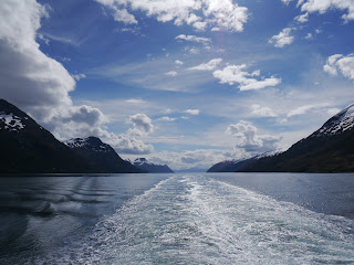
The narrow passages navigated by the ferry throughout the majority of the journey provided a constant close view of the edges of the channels formed by islets, mountain slopes, glaciers and countless small inlets. The weather was clear and windless, so for much of the journey I marveled at the views across a perfectly calm channel (like a mill pond). I was lucky to have the company of two French women (Chamille and Marie) that I met the previous week in Puerto Natales.


Early Morning View Approaching One of the Many Narrow Passages On-Route


Ferry Yaghan with a Wonderful Backdrop

I enjoyed yet more amazing Patagonian skies with vast views to the far horizon across multi-layered clouds sitting in a rich sky - a true tapestry of numerous tones of blue and white, (what creates these amazing Patagonian skies - is it the clarity of the air)?


Ah....Those Southern Patagonian Skies.....


A Glacier ´Tumbling´ Into our Seaway


25th & 26th November: Puerto Williams, Chile

Puerto Williams on the island of Isla Navarino (across the Beagle Channel from the (much larger) island of Tierra del Fuego)) is the southern-most (notable) town in the world (despite what the Argentines may claim about Ushuaia on Tierra del Fuego). As one might expect for such an out-post, there is not a lot happening in Puerto Williams, but it serves as a good base for walks around the peaks of the Dientes de Navarino (the ´Teeth of Navrino´) - so called because of the teeth like line of mountain peaks.

While there, I made a one day trek to see the peaks (one day was enough as I must say that after so much mountain trekking in Patagonia, me and (my knees in particular) feel a bit walked-out for the time being). While on my trek I was fortunate to see a condor sitting on an outcrop just 15 metres away. Throughout the remainder of the walk, I continued to see him demonstrating his effortless use of thermals.


A Condor Surveys the Valley Below
(of Valley of Rio Ukika on Isla de Navarino)


La Dientes de Navarino (The Teeth of Navarino) With Laguna el Salto Below


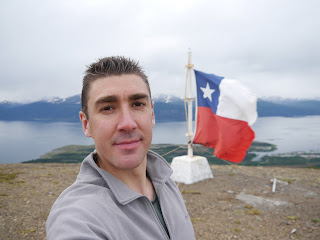
Tim in the Deep, Deep South of America: At the Mirador (View-Point) above Puerto Williams With the Beagle Channel Behind Me


27th to 30th November: Ushuaia, Argentina

The journey across the Beagle Channel from Puerto Williams (Chile) to Ushuaia (Argentina) is not easy (nor is it cheap) as there are no timetabled crossings, just fast launches (boats) or small planes which will only make the journey if there are sufficient passengers wanting to make the crossing. I elected to take the fast launch so enjoyed a rapid 75 minute boat ride.


The Fast Launch I Took from Puerto Williams to Ushuaia (Across the Beagle Channel)


I travelled to Ushuaia so that I could catch a flight to Buenos Aires where I will take a ferry across the Rio de la Plata to Uruguay. My time in Ushuaia was mainly spent planning the Uruguayan leg of my travels. I did however, make time out to join a couple of friends from the hostel to visit the maritime museum which is housed in an old prison (many of the exhibits are in the old cells). It provides a history of the early naval exploration of this area, the Yámanas (indigenous people who used to live on Tierra del Fuego), Antarctic expeditions and the prison itself.

Some great laughs were provided by some poor translations:

"He placed a plaque at Cape Horn for the survivors of the sucked ships.." I guess the ships were sucked and sucked until they sunk!

The following text may not be in error, but simply a weird quote:

"They had few choices: Brazil, Uruguay or Argentina. The choice was easy: A big country, simple settling down formalities and no need of going into the forest". From this I assume that in Uruguay and Brazil you are woken at 4am every day for your obligatory walk into the forest - either that or there are no toilets at all and one has to go behind a tree to squat!

The following is a wonderful example of Edwardian British pomposity written by Dulse in 1902. It relates to the anthropological description of the Yámana people who were documented by the likes of Darwin et al:

"They are short and ugly, figures of crooked and contracted legs in whom Darwin is thought to have found the missing link". Flip, don´t expect to get invited round to their place for tea!


Wednesday, November 23, 2011

2011, 13th - 20th November: Puerto Natales, Chile - Torres del Paine

2011, 13th - 20th November
Puerto Natales, Chile

15th - 18th November: Walking the W Circuit in The Torres del Paine National Park

For a full complement of photos, follow this link to the set my Flickr account:
 
http://www.flickr.com/photos/67212524@N04/sets/72157628103589165/


The Torres del Paine national park in Chile is famous for it´s numerous granite spire-like peaks and many beautiful valleys which are all surrounded by numerous lakes of wonderful rich blues. A popular way to see many of the key vistas is to complete "The W Circuit" - so called because the trails followed form a W shape. It is normally walked in 5 days, but I chose to do it in 4 as this was the duration of the forcasted dry weather, plus I like a tough physical challenge (nutter). All gear has to be carried if you want to do the cheaper camping option (rather than staying in the refuges) - I camped so that meant a heavy(ish) pack with the crazy amount of food I get through.

I completed the trek in mid-November which is before the peak season period from December to February. Despite this the routes were pretty busy with walkers - the trails must be overly busy during the peak months.

I walked the first day with Sergio (a Brazilian guy I met three days before on a bus to Calafate), but on the morning of Day 2 he had to head back to Puerto Natales so I made the rest of the trek alone.

Day 1: The Torres
 
The morning was occupied by getting into the park, so only a part day of walking. I walked up Valle Ascencio to set up camp in Campamento Torres. After that, a climb up to the mirador (viewing point) at Base de las Torres gave a wonderful view across a lagoon to the towering granite spires of Torre Central and Torre Norte.


The W Circuit Day 1: View from the Base de Torres


Day 2: Valle del Frances
 
This was the first of two long days. I returned down Valle Ascencio, then past Lago Nordenenskjold to the bottom of Valle del Frances. Most people then stop and camp at Campamento Italiano, but I continued and climbed up to the top of the valley as this would help to save a day - plus I could camp in the circular vista at the top of the valley at Campamento Britanico. This meant that the day ended at gone 9pm but I was able to enjoy an evening view of the 270 degree panorama from above the mirador at the top of Valle de Frances which was spectacular.


The W Circuit Day 2: Part of the Vista at the Top of Valle del Frances


The W Circuit Day 2: Tim Enjoying the Vista at the Top of Valle del Frances


Day 3: Glaciar Grey
 
The second of two long days. I returned down Valle del Frances, past Lago Skottsberg then climbed up the valley alongside Lago Grey - a sometimes frustrating day in the heat as every climb was matched with a descent, slowing progress somewhat. The closer I got to Glaciar Grey, the more icebergs were visible on Lago Grey. The whites of the icebergs were stratified by lines of electric blue. The person who named Glaciar Grey must have had bad luck with the light on the day they saw it, because I was lucky enough to enjoy its rich blue hues throughout my time there. After reaching Campamento los Guardas (which is in a fantastic location above the glacier), I set up camp then carried stove and dinner gear across to the rocks above the glacier to have a cup of tea and a hot dinner in a location with a wonderful view!


The W Circuit Day 3: The Rich Blue Glaciar Grey Meets Lago Grey


The W Circuit Day 3: A Great Spot for a Cup of Tea & a Hot Dinner!


The W Circuit Day 3: A More Civilised Version of "Brit-Abroad" - An Englishman and His Cup of Tea in a Great Location!


Day 4: The Return Leg
 
I returned back down the route alongside Glaciar Grey down to the shores of Lago Pehoe where I waited for a catamaran that took me across the lake to connect with a bus back to Puerto Natales.